
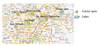
Below is the tourist map of Bangalore. Saara and her friends have half a day to cover some tourist attractions. Which of the following would be the most optimal sequence to follow, according to you?
Important Questions on Visualising Solid Shapes
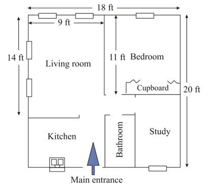
Architect use scale drawings of different buildings to find the actual set up of that building. They use different perspectives to sketch these drawings. Floor plan of a house is to be made in the scale , what will be the different dimensions of the floor in the scale drawing.
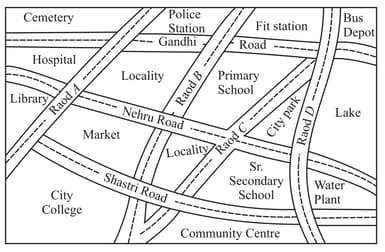
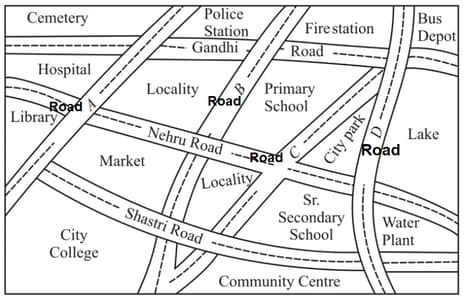
Look at the given map of a city. Answer the following:
Which is further south, the primary school or the Sr. secondaary School?

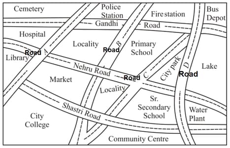
Look at the given map of a city.
Answer the following:
Which is further East, the city park or the market?
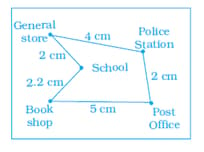
In the given map, the distance between the places is shown using the scale . Then the actual distance (in ) between school and the book shop is
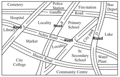
Look at the given map of a city. Colour the map as follows: Blue — water, Red — fire station, Orange — Library, Yellow — schools, Green — Park, Pink — College, Purple —Hospital, Brown — Cemetery.
Look at the given map of a city. Mark a green ‘X’ at the intersection of Road ‘C’ and Nehru Road, Green ‘Y’ at the intersection of Gandhi Road and Road A.
Look at the given map of a city. Answer the following:
Which is further east, the city park or the market?

Look at the given map of a city. Answer the following:
Colour the map as follows: Blue-water, Red-fire station, Orange-library, Yellow-schools, Green-park, Pink-College, Purple-Hospital, Brown-Cemetery.

Look at the given map of a city.
Draw a short street route from Library to the bus depot.
Taking scale: , find the actual distance between these two cities.
Look at the given map of a city. Answer the following:
Mark a Green ‘’ at the intersection of Road ‘’ and Nehru Road, Green ‘’ at the intersection of Gandhi Road and Road .

Look at the given map of a city.
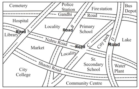
Which is further South, the primary school or the Sr. Secondary School?


