
MEDIUM
Earn 100
Conventional signs are symbols used on maps to represent different man made features.
50% studentsanswered this correctly
Important Questions on Topographical Maps
MEDIUM
MEDIUM
MEDIUM
Contours
HARD
MEDIUM
MEDIUM
EASY
Footpath with bridges
EASY

Find out the direction of and from .
MEDIUM
HARD
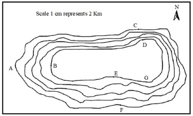
Name the geographical feature formed by contours.
HARD
MEDIUM
Study the extract for topographical sheet 63 K/12 shown in the flgure on page 68 and answer the following questions.
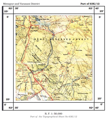
In which part of the sheet area is Lower Khajuri Dam located?
HARD

Name the type of slope between and and and and .
HARD
MEDIUM
MEDIUM
MEDIUM
HARD
EASY
EASY


